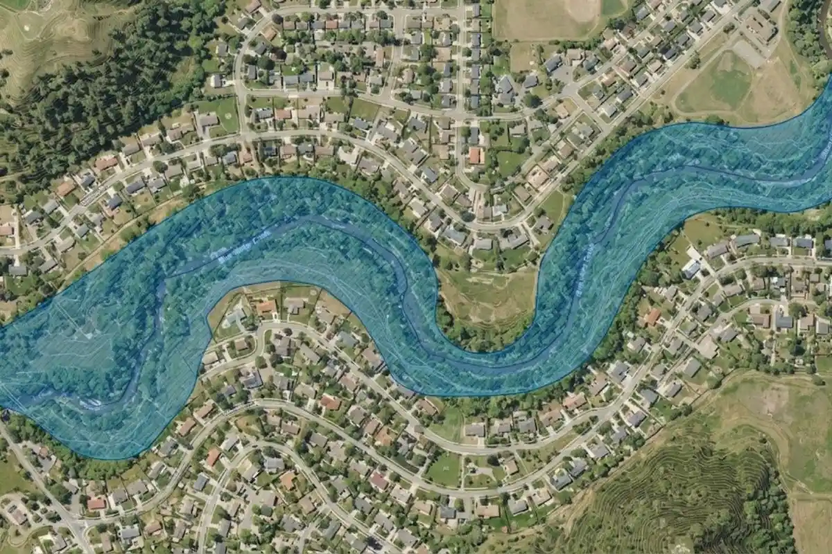
FEMA has been in the process of updating the Flood Insurance Rate Maps for Montgomery County, and the new maps are on track to become effective in spring 2026, per FEMA's published timeline, though the agency notes that date is subject to change pending the appeal review process.
If you own property anywhere near a stream valley, a pond, or low-lying ground in this county, this is worth five actual minutes of attention rather than a skim. Map changes can shift your flood zone status, and flood zone status affects both insurance requirements and cost.
The Timeline So Far
Montgomery County and the cities of Gaithersburg and Rockville held public information sessions on the proposed changes in February 2024, and FEMA opened a 90-day appeal and comment period starting January 17, 2025, during which community partners could challenge the technical or scientific basis of the new mapping data.
That appeal period has since closed, with finalization of the preliminary data following appeal resolutions expected to lead into the maps becoming effective in spring 2026, the point at which any new flood insurance requirements actually take effect for affected properties.
Preliminary Vs. Effective: The Distinction That Matters
Two different map versions exist right now, and confusing them is the most common mistake homeowners make in this process. The effective map is the one currently governing insurance requirements, it's what your lender and insurer use today.
The preliminary map is FEMA's proposed update, reflecting new data and modeling, and it's not yet legally in force. Properties can be in a lower-risk zone on the effective map and a higher-risk zone on the preliminary one, or vice versa. And until the preliminary map becomes effective, only the current map's designation legally applies.
The practical implication: if the preliminary map shows your property moving into a mapped flood zone, you have a window before that requirement takes effect, and that window is exactly when it makes sense to act rather than wait.
Why This Matters Even If You've Never Flooded
Map updates reflect new engineering analysis, updated rainfall data, and changed development patterns, not just recent flood history, so a property with a clean flood record can still see its designation shift.
If your home moves into a designated high-risk zone (a Special Flood Hazard Area) and you carry a mortgage, your lender will typically require flood insurance as a condition of the loan, regardless of whether you've ever personally experienced flooding.
Conversely, some properties move out of mapped zones as data improves, which can end a previously mandatory requirement. Either direction is worth knowing before it's presented to you as a surprise at closing, refinancing, or renewal.
The county's documented flash-flood pattern gives this more than bureaucratic weight: the 2021 flooding that struck Rockville's Rock Creek Woods Apartments and the July 2025 flash flood that generated over 100 rescue calls in two hours both illustrate a genuine, recurring risk that map updates are, in part, trying to capture more accurately.
This isn't paperwork describing a hypothetical; it's paperwork trying to catch up to documented events.
How To Check Your Status Now
Three practical steps, none of which require becoming a floodplain expert. First, contact your insurance agent directly and ask specifically whether your address falls under a changed designation in the preliminary maps. Agents handling Montgomery County policies should be tracking this update already.
Second, Montgomery County's Department of Permitting Services has published information on the preliminary maps and appeal process, worth a direct check if you want the county's own framing rather than a third party's summary.
Third, if you're near any of the geography that tends to move with these updates, stream valleys, the county's pond and lake features (including several within Montgomery Village itself), or low-lying grade, treat the “probably fine” assumption as worth verifying rather than assuming.
The Bigger Picture: Infrastructure Age
Map updates arrive alongside a broader story about regional water infrastructure showing its age. In January 2026, a section of the 72-inch Potomac Interceptor sewer line, a major regional line, not a residential lateral, collapsed near Clara Barton Parkway in Montgomery County, releasing an estimated 240 to 300 million gallons of untreated wastewater into the Potomac River, among the largest such spills in U.S. history.
That event involved regional trunk infrastructure entirely separate from home plumbing and flood risk, but it's a useful data point on a common theme: much of this region's water and sewer infrastructure dates to the mid-20th century, and both the pipes beneath the street and the flood maps describing the water above it are, in different ways, catching up to their age at the same time.
What To Do With This Information
If the preliminary maps affect your property, the practical options are the same ones available to anyone in a flood-risk zone: purchase or increase flood coverage before the requirement is mandatory (often less expensive during a voluntary window than after a mandate), evaluate flood-mitigation measures for the property itself (grading, sump backup, foundation sealing), and keep documentation of your home's actual flood history, or lack of one, which matters for both insurance conversations and any future appeal of the property-specific designation.
And regardless of what the maps eventually say, the water damage response doesn't change: our flood damage restoration team responds to Montgomery County flooding whether the source is a mapped flood zone or a garden-variety storm that overwhelmed a yard the maps never flagged at all.
Checking This Doesn't Cost You Anything
Worth emphasizing since insurance conversations can feel like they're leading toward a sales pitch: verifying your flood zone status costs nothing, and finding out you're unaffected is itself a useful answer. The only bad outcome from checking is discovering a change that requires action.
And that outcome is considerably better discovered now, during the voluntary window, than at a mortgage renewal or after a flood event makes the question moot.
If you own property near any of Montgomery Village's ponds, the Seneca or Rock Creek watersheds, or simply aren't sure where your address sits relative to mapped flood zones, this spring's map transition is a genuinely good prompt to find out.
And regardless of what your zone designation says, our Rockville and Gaithersburg service area pages cover the flood-risk geography specific to those two cities in more detail, since the county's flash-flood pattern doesn't distinguish between mapped and unmapped addresses when the water actually arrives.
Dealing with this right now in the Montgomery Village area? Our dispatch line is answered 24/7: (240) 207-7823